Iran poised for landmark year in space with Kowsar, Zafar, and Paya satellite launches

By Ivan Kesic
Iran's space program, embodying national resilience and technological prowess, is poised for a landmark year with the planned launches of its advanced Kowsar, Zafar, and Paya satellites.
Together, these spacecraft will form a sophisticated constellation designed to revolutionize the country’s growing capabilities in earth observation, precision agriculture, and environmental monitoring.
Iran’s space program stands as a testament to phenomenal scientific progress, having achieved remarkable technological breakthroughs despite decades of illegal Western-imposed sanctions.
The planned launches of the Kowsar 1.5, Zafar, and Paya satellites within the current Iranian calendar year mark a major milestone, demonstrating the nation’s growing self-reliance.
These satellites, developed by Iranian engineers associated with various knowledge-based companies in collaboration with the Iranian Space Agency (ISA), reflect a strategic push to establish an independent satellite constellation that will support agricultural, environmental, and surveillance needs.
This ambitious program, managed under the leadership of Hassan Salariyeh at the Iranian Space Organization, underscores Iran’s commitment to peaceful technological advancement.
It also highlights the country’s efforts to deepen strategic space cooperation with international partners, cementing its position as an emerging leader in space technology.
Speaking to local media on Sunday, Salariyeh confirmed that the ISA has several satellites scheduled for launch by the end of the Iranian year, specifically naming the second prototype of the Kowsar, as well as the Zafar and Paya satellites.
He also announced the upcoming launch of the second model of the Nahid 2 satellite and test versions of the Shahid Soleimani system.
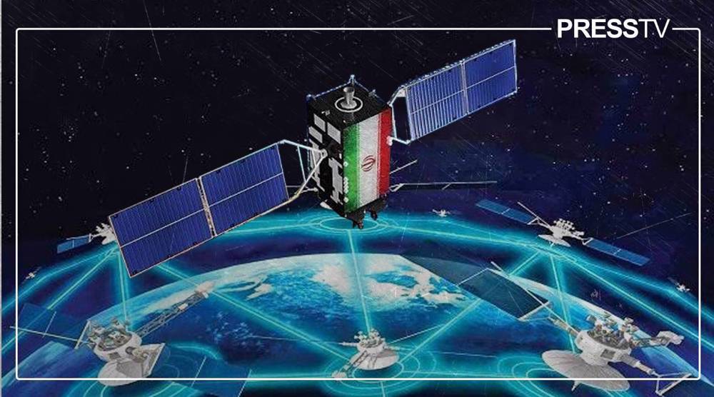
Kowsar 1.5 satellite
The Kowsar 1.5 satellite is an advanced, upgraded version of its predecessor, representing a significant step forward in Iran’s space-based remote sensing capabilities.
This state-of-the-art satellite is designed for high-resolution imaging with a primary focus on precision agriculture. It will provide daily imagery of plant greenery every 24 hours, supporting agricultural monitoring, crop health assessment, and efficient resource management.
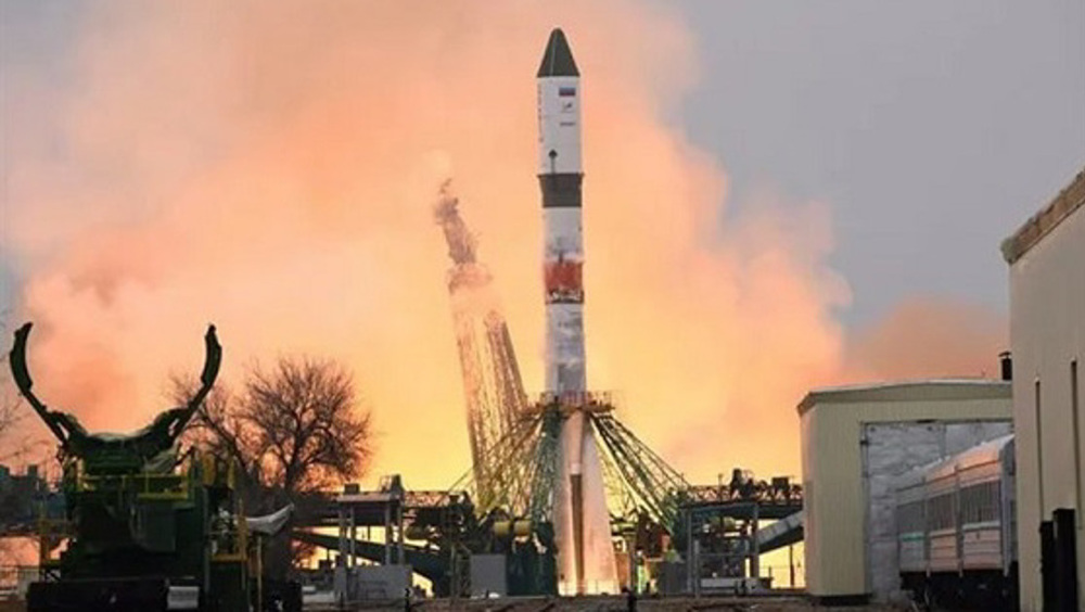
Kowsar 1.5 builds directly on the success of the original Kowsar and Hodhod satellites, which were successfully launched into orbit from Russia's Vostochny Cosmodrome on November 5, 2024, aboard a Russian Soyuz rocket.
Developed by the Iranian knowledge-based aerospace company SpaceOmid, the satellite highlights the pivotal role of Iran’s private sector in advancing space innovation. Over 85 percent of its components are domestically produced, underscoring Iran’s impressive strides toward technological self-reliance.
Kowsar 1.5 is planned for deployment into a 500 km low Earth orbit (LEO), ensuring superb imaging performance. It boasts an impressive resolution of 3.45 meters per pixel, making it highly effective for detailed agricultural monitoring, land surveillance, and territorial mapping.
Its mission includes delivering high-resolution imagery for real-time agricultural data, enabling improved crop health assessment and yield optimization. In addition, the satellite will support border monitoring, infrastructure assessment, and other surveillance applications.
The spacecraft features highly efficient solar panels, with telemetry data from the original Kowsar confirming their effective charging and discharging performance. It also incorporates advanced optical sensors capable of capturing detailed, high-quality imagery.

The Kowsar 1.5 satellite has an estimated orbital lifespan of approximately two years, consistent with the original Kowsar satellite. However, it incorporates critical modifications to resolve communication challenges encountered by its predecessor, specifically a mismatch between the satellite’s antenna and ground station specifications that hindered image transmission.
Key upgrades include revised and enhanced attitude control algorithms to ensure superior orbital stability and pointing accuracy, along with a significantly upgraded power subsystem.
This improvement not only strengthens overall reliability but also has the potential to extend the satellite’s operational life beyond the originally projected 3.6 years.
The communication subsystem has been comprehensively overhauled to operate across the S, U, and V bands, delivering enhanced data downlink speeds and greater transmission reliability.
Additionally, a subtle yet impactful enhancement has been made to the camera payload, suggesting meaningful improvements in image processing or sensor sensitivity to further refine its remote sensing performance from its 500 km orbital altitude.
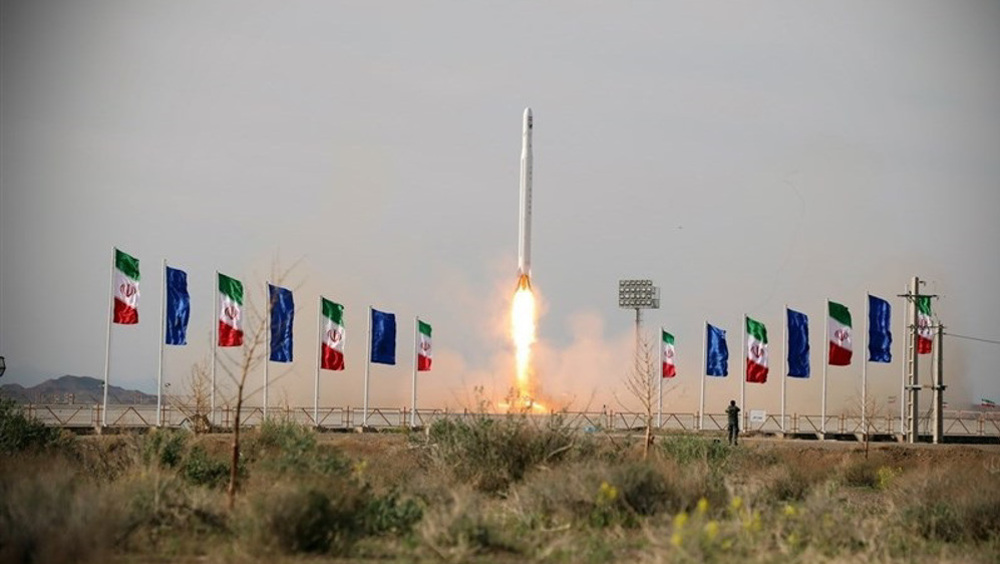
The launch of Kowsar 1.5 is scheduled in the coming months aboard a Russian Soyuz rocket.
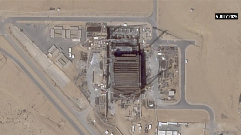
Iran is also actively considering a domestic launch option from the newly developed Chabahar Space Center, a move that would further demonstrate the country’s growing autonomy in launch capabilities.
Zafar satellite
The Zafar satellite marks another significant milestone in Iran’s space program. It is an advanced earth-observation satellite designed to provide high-resolution imaging for critical applications in agriculture, environmental monitoring, and disaster management.
Developed by the Iran University of Science and Technology (IUST) in partnership with the Iranian Space Agency (ISA), the project exemplifies the powerful collaboration between Iran’s academic institutions and its governmental space bodies.
Zafar follows earlier iterations, including Zafar-1 and Zafar-2, and builds upon their technological foundations.
Planned for deployment into a 500 km low Earth orbit, Zafar will align with other Iranian observation satellites to ensure consistent and integrated imaging coverage across the region.
While the exact resolution of this latest Zafar model has not been officially confirmed, estimates place it at approximately 10–15 meters per pixel, an improvement over Zafar-1’s 22.5 meters per pixel, making it significantly more effective for environmental and agricultural monitoring.
Its mission profile includes providing high-resolution imagery for agricultural applications such as crop monitoring and land use planning, conducting vital environmental surveillance, including water resource management and deforestation tracking, and supporting disaster management operations by accurately mapping flood- or earthquake-affected areas to aid relief efforts.
Although specific details on its payload remain limited, the satellite is expected to carry advanced optical sensors, potentially multispectral or panchromatic, complemented by robust telemetry and communication systems for reliable data relay to ground stations.
These features build directly on lessons learned from the partial success of Zafar-1.
With an estimated orbital lifespan of one to two years, typical for small observation satellites in low Earth orbit, Zafar is scheduled for launch in fall 2025 (September-November) aboard a Russian Soyuz rocket alongside the Paya satellite. A domestic launch using Iran’s Simorgh rocket, from the Chabahar Space Center, remains under consideration pending the facility’s readiness.
Zafar-2 forms a vital component of Iran’s emerging satellite constellation, designed to operate in tandem with Kowsar and Tolou-3 to establish a networked system for continuous earth observation.
The program underscores Iran’s growing academic and technological expertise, as well as its determination to advance in space science despite sanctions restricting access to foreign technologies.
Paya satellite
Paya satellite
The Paya satellite completes this trio of advanced spacecraft, serving as an earth-observation satellite designed for sophisticated imaging and data collection.
It will complement the Kowsar and Zafar satellites in agricultural, environmental, and surveillance applications, strengthening Iran’s integrated satellite constellation.
Developed by Iranian knowledge-based companies in collaboration with the Iranian Space Agency (ISA), the Paya project underscores the expanding role of Iran’s dynamic private sector in the nation’s space ecosystem. As part of the planned constellation, Paya is a critical element alongside Kowsar and Zafar.
The satellite is planned for deployment into a 500 km low Earth orbit, consistent with its counterparts Kowsar and Zafar, allowing for coordinated observation missions and enhanced data synergy.
While no official resolution details have been disclosed, estimates suggest a capability in the range of 10–20 meters per pixel, comparable to Zafar-2, aligning with its complementary role in the constellation.
Paya’s mission profile is expected to include agricultural monitoring, environmental observation, and surveillance tasks, though specifics have not been publicly released.
It will likely contribute essential data for precision agriculture, national resource management, and demarcation projects, functions consistent with Iran’s strategic emphasis on self-sufficiency and security.
The satellite’s payload likely includes reliable optical or multispectral sensors, supported by robust telemetry and communication systems for efficient data relay to ground stations.
Its orbital lifespan is estimated at one to two years, typical for observation satellites in low Earth orbit.
The launch is scheduled for fall 2025 aboard a Russian Soyuz rocket, alongside the Zafar satellite. However, a domestic launch via Iran’s Simorgh rocket, likely from the newly developed Chabahar Space Center, remains under consideration, reflecting Iran’s growing focus on independent launch capability.
Although specific technical details about Paya remain scarce, possibly due to its later stage of development or deliberate strategic discretion, its intended role is clear: to complement Kowsar’s high-resolution imaging and Zafar’s broader monitoring functions.
Together, these satellites will form a comprehensive and powerful orbital observation network, marking a decisive step in Iran’s pursuit of a self-reliant space infrastructure.
Iran's orbital game-changer: Martyr Soleimani constellation marks new era of indigenous space power
Iran’s space program pressing forward with renewed momentum: Minister

Tederox and Padynex: Iran’s entry into elite club of antibody-drug conjugate manufacturing


Europe braces for hard winter as gas supplies dwindle
Saudi Arabia, Qatar and Jordan condemn Israeli incursions into Syria
Shiraz performs over 16,100 organ transplants, records 43.5 donors per million
Iran says ‘no technical talks’ with US scheduled for this week in Doha
North Korea says Japan turning into 'war nation', slams joint war game with US
China imposes export controls on 40 Japanese entities amid tensions with Tokyo
Pezeshkian: Iran to recover $6 billion in frozen funds under Islamabad MoU
Israel rebrands Gaza displacement scheme amid global outrage: Report