Dramatic aerials trace lava flow of Kilauea
Incredible images from the US Geological Survey trace the flow of lava from the Kilauea Volcano approximately 50 kilometers until it reaches Kapoho Bay.
The images, taken at 6:30 a.m. local time on Wednesday, show a river of hot, molten lava making its way down Highway 132 to the bay, a popular vacation spot known for its sandy beaches and snorkeling.
The ever-creeping wall of lava has engulfed two entire seaside housing tracts at the eastern tip of Hawaii's Big Island, an area where civil defense officials said nearly 280 homes once stood.
The obliteration of the Kapoho Beach Lots and Vacationland subdivisions by a churning river of molten rock some 3 to 4.6 meters tall brings to at least 350 the number of homes and other structures consumed by volcanic lava during the past month.
(Source: Reuters)
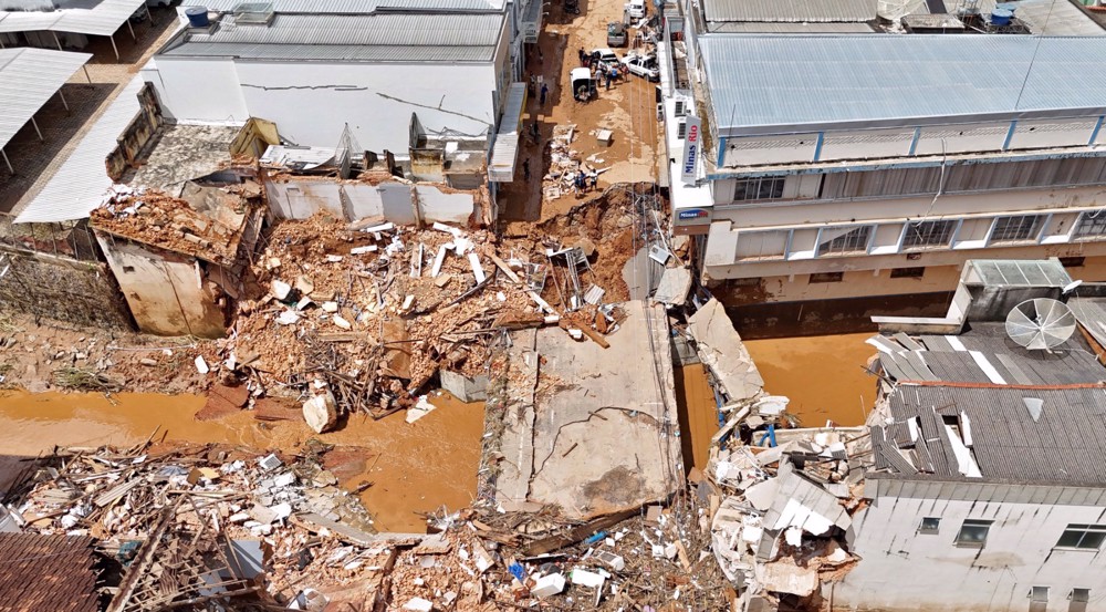
Brazil: Uba River floods destroy bridge and buildings, leave people missing

Gaza bakery supports displaced families ahead of Ramadan Iftar
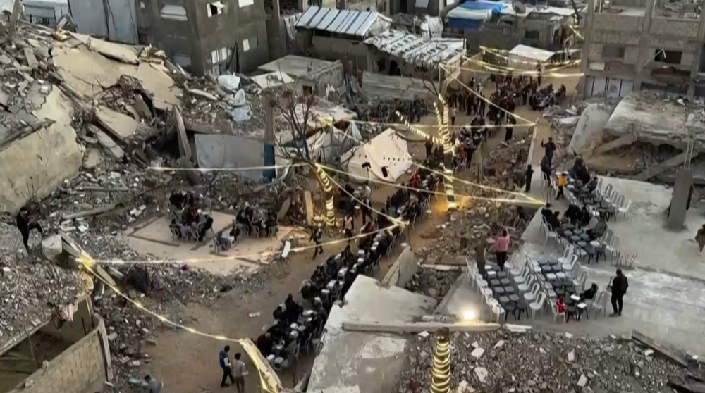
Gazans break Ramadan fast amid rubble of their destroyed homes


Lebanon launches 5th round of talks with Israel as ceasefire violations persist
Putin says West preparing for war with Russia, warns Moscow ready to respond
60-day negotiation framework, seven conditions: Iran’s strategic red lines shape oversight, leverage
Trump eyes to drag carmakers into weapons production as stockpiles deplete
Iran, Oman agree to form joint committee on future administration of Hormuz Strait
Iran, Pakistan discuss regional security as Pezeshkian begins talks in Islamabad
Iran's military yet to deploy full capabilities: Senior Army commander
Russian veterans honor Iran’s resistance against US-Israeli aggression