NASA captures image of Hurricane Harvey from space
Satellite images recently released show Harvey, a slow-moving tropical storm, which has brought catastrophic flooding to Texas and killed at least nine people.
It has also led to mass evacuations and paralyzed Houston, the fourth most-populous US city. Some 30,000 people were expected to seek emergency shelter as the flooding entered its fourth day.
US President Donald Trump was scheduled to arrive in Corpus Christi, near where Harvey came ashore on Friday as the most powerful hurricane to strike Texas in more than 50 years.
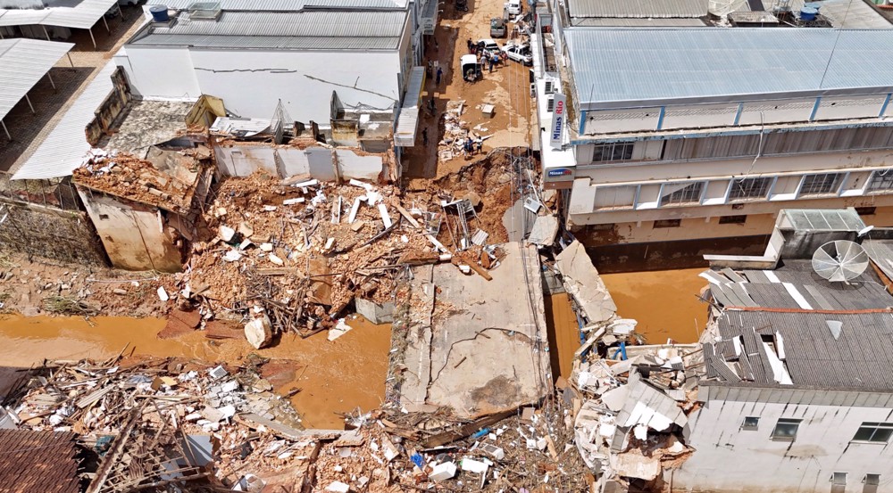
Brazil: Uba River floods destroy bridge and buildings, leave people missing

Gaza bakery supports displaced families ahead of Ramadan Iftar
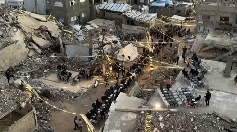
Gazans break Ramadan fast amid rubble of their destroyed homes


Hezbollah foils Israeli infiltration attempt by leading invading forces into 'killing zone'
Iran condemns French FM's meddlesome remarks as 'height of hypocrisy, duplicity'
US emerged from war ‘desperate, defeated': Leader's advisor
US intl. warns: Netanyahu may sabotage Iran-US MoU to prolong aggression
‘Hand on trigger’: Army stresses readiness to defend Iran against any violation
Key Parliament commission hails Leader’s MoU message, says continued victories hinges on unity
UK PM advised to prepare for 'dignified, orderly exit'
UNICEF: Ceasefire in besieged Gaza is a ‘deadly illusion’ for Palestinian children